
The Quick and Dirty:
Location – Starting off at the south end of O’Neill Regional Park on Mesa trail, the Arroyo Trabuco – Tijeras Creek loop takes you around the city of Ranch Santa Margarita. See route on geoladders.com.
Distance – It is roughly a 14-mile loop if you don’t miss the turnout to Tijeras Creek like we did.
Terrain Type – Mix of double track and single track. Rocky stretches, creek crossings, wood stretches and sand.
Difficulty – Good for beginner-intermediate mountain biking with a few climbs where I had to descend my bike and walk up the hill
Best Time – Year-round, there are a few stream crossings that can get quite deep after a big rain storm. Personally, I do think spring is the best time to see this trail, because everything was still lush from the recent rain events.
Parking- Parking at O’Neill park’s main lot is not free, we park on El Camino Montana Road parallel to the Mesa Trail.

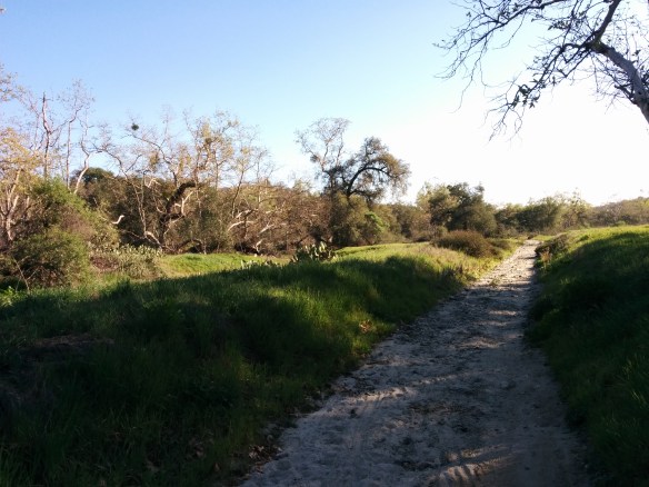
Chasing the sunlight at the end of the ride
Mountain biking has been something Louis has been trying to get me into since we moved to south Orange County, but it never really clicked. I’ve always felt intimated by the single track trails and falling off my bike while trying to overtake a particularly tough hill (this has already happened a handful of times).
Even though it’s been well over a year since I’ve hopped on a mountain bike, the weather this weekend was too beautiful to stay inside. We decided to dust off our mountain bikes and go for a long ride at the Tijeras Creek loop near our home.
We enter the trail on El Camino Montana, just past the right turn on Via Sosiego. Pass the fence opening and a paved road that runs along the park perimeter. Heading south, follow the paved road and make an immediate right down the hill. If you hit a turn around, you went too far. Alternatively, you may turn right and head north along the Upper O’Neill Trail and left down Twist Tire. You can follow the paved road into the other side of the park, or take a short cut and cross onto a dirt path and through Trabuco Creek into the picnic area. Head straight through and to your left you will find the entrance to the Arroyo Trabuco trail.
The trail starts out as a double track relatively flat for the first few miles through O’Neill Park. Further in, the trail becomes a washed out rocky double track. Follow the trail and signs into the Tijeras Creek section. Watch your lines when biking through the rocky sections. There are several water crossings on the trail, and a few were ankle deep.
Rocky section from the first section of the trail

Walking our bikes across one of the stream crossings
The trail environment changes drastically, starting with open meadows and rivers, to heavily wooded areas, and opens up to desert landscapes. About a third way into the ride is one of my favorite spots on the trail. It is a heavily wooded area that is completely different from the exposed feel at the beginning of the trail.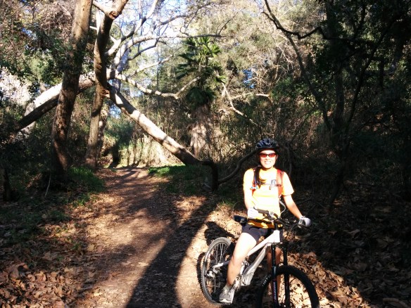 Several trails traverse through the area. Tijeras Creek is a quick left turn if you are heading southwest on Arroyo Trabuco. If you miss the junction (as we did), there is another opportunity to head back up just as you the trail turns from dirt to concrete (and passes under Oso Parkway). Make a left at the T-intersection and follow the trail back up under Oso Parkway on the other side of the creek. Take the single track out and you are back on Tijeras Creek.
Even though avid mountain bikers will usually say this is a beginner trail, it was still a strenuous ride for a novice like myself. The hill climbs got to be difficult towards the end of the ride as I was got tired. Hopefully with the first ride of the year out of the way, we will get on our bikes more the rest of the year.

Loading up the bikes before heading home
