Xterra!!

Last weekend we welcomed a 2006 Nissan Xterra 4×4 to our family! For the past few years we found ourselves limited to our backpacking and hiking trips without a high clearance, 4×4 vehicle. We have pushed my small sedan to its limits with off-road driving and finally decided it was time to invest on a real off-roading vehicle. We bought the car secondhand since we plan to use the Xterra for rough terrain driving and have already tested it out on a local trail. Doesn’t she look beautiful covered in dust? We are so excited for all the new places this car will take us! IMG_20150124_084228

Trail Report- Cassidy Arch at Capitol Reef National Park

The Quick and Dirty:
Location: Cassidy Arch in Capitol Reef National Park
Distance: 3.6 miles round trip
Terrain Type: Well marked trail within the National Park. Watch for trail markers towards the end of the arch as the beauty of the surrounding can be very distracting!
Difficulty:  Easy to moderate with some elevation gain
Best Time: Avoid summer as the trail is very exposed
Duration: Around 2-3 hours

P1070753

Cassidy Arch, if you look closely, Louis is sitting in the middle

Continue reading

Trail Report- Lick Wash Trail at the Grand Escalante Staircase National Monument

The Quick and Dirty:

Location: Grand Escalante Staircase National Monument
Distance: 8 miles round trip but we only did about 4 miles before losing light and turning back
Terrain Type: Slot Canyon, although the canyons are much wider than the Willis Creek canyons we hiked previously
Difficulty:  Easy during summer with long days.
Best Time: Year round
Special Conditions: Approximately 20 miles off-roading, 4WD and high clearance vehicle recommended during wet seasons, although we did this in our 2WD sedan when the road was in good condition
Duration: Around 4-5 hours, however we only hiked the first 2 miles

P1070670

Entry point of the Lick Wash Trail

Continue reading

Trail Report- Willis Creek at the Grand Escalante Staircase National Monument

The Quick and Dirty:

Location: Grand Escalante Staircase National Monument
Distance: 4.8 miles round trip but we only did about 2.5 to 3 miles
Terrain Type: Slot Canyon, water resistant shoes recommended for portion of the hike
Difficulty:  Easy during summer and difficult to finish the entire hike when the slot canyon is frozen in the winter time.
Best Time: Early summer to late fall, we did this hike in late December and were not able to complete the entire trail.
Special Conditions: 6.3 miles off-roading, 4WD and high clearance vehicle recommended during wet seasons. Avoid the trail when there is heavy rain or flash flood warning. Be sure to check the weather before you head out!
Duration: The trail took us a couple hours because we were only able to access the first mile and a half due to thin ice.

P1070604

Willis Creek is located at the western portion of Grand Escalante Staircase National Monument right next to Bryce Canyon National Park. Known for its famous slot canyons, we set out on our second day of our winter vacation to hike Willis Creek and Lick Wash trail. This post only talks about Willis Creek, I will discuss Lick Wash trail in my next post.

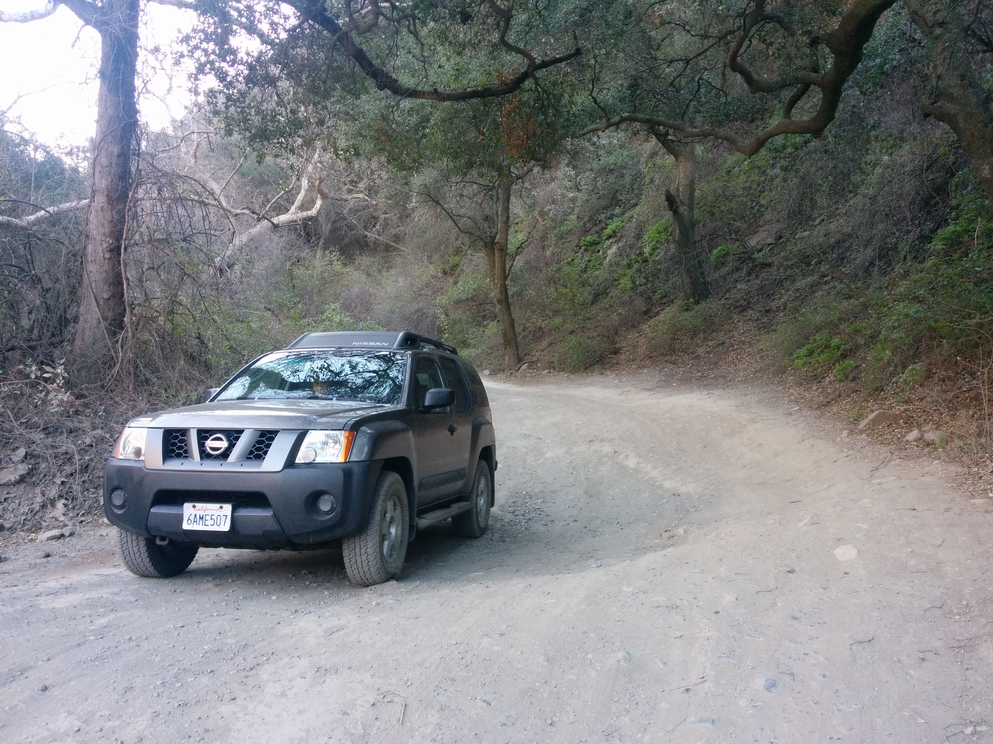
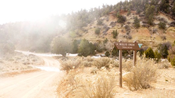
The drive to Willis Creek from Ruby’s Inn near Bryce Canyon National Park took about 30 minutes with 6.3 miles of off-roading. Thanks to great driving directions given by Your Hike Guide, we had no trouble finding the trail head. We did this drive with our 2WD Honda Accord on a dry and beautiful sunny winter day. We were very fortunate with the road conditions and had no problems in the off-road portion of the drive. However, there was no way we could have made the drive if the trail is muddy or flooded.

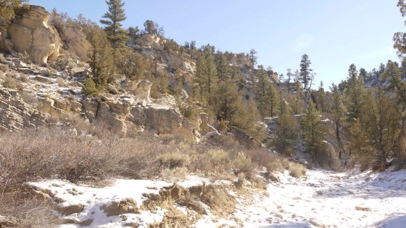
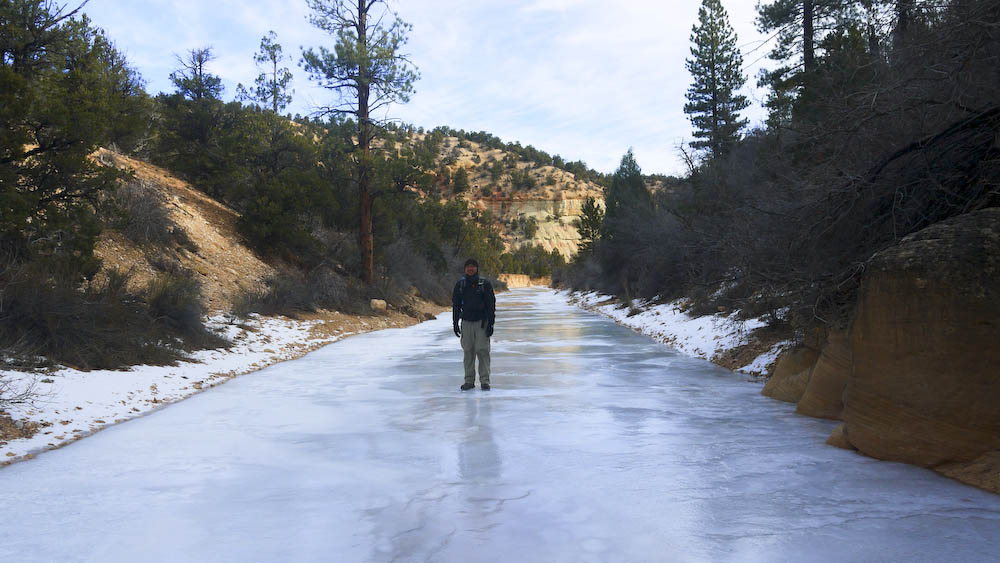
We got to the trail head around 11AM. It was a beautiful sunny day and the water in the slot canyon was still frozen at the start of our hike.

P1070607

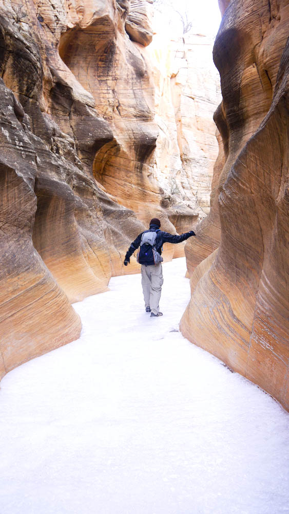
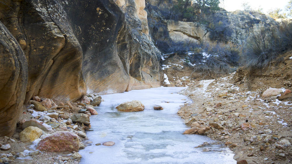
Entrance of the first slot canyon

P1070628

Sliding into the slot canyon, at this point the ice is still froze solid and holding our weight.

P1070620

P1070634

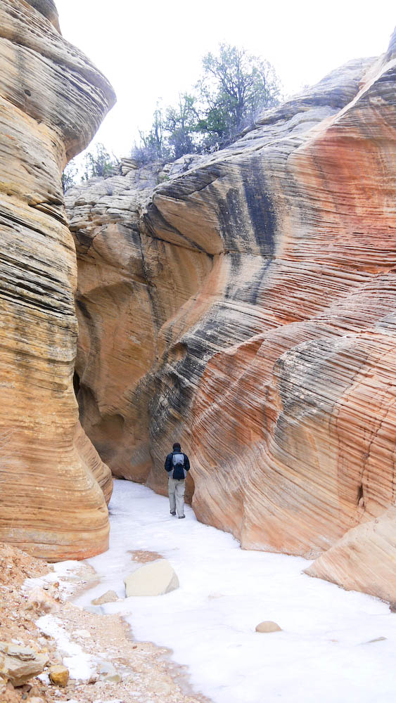
Coming out of the slot canyon, into a frozen river

We were only able to travel a mile and a half into the trail. When we got to the entrance of the second slot canyon, the ice became too thin to walk through. Even though our hiking boots were water-proof, we did not want to risk getting our feet wet. By the time we turned back, a fair amount of  ice has melted, making it difficult to walk on without cracking.

P1070660

Thin ice during our walk back to the trail head.

Even though we were not able to finish the entire hike, we were so glad we were able to hike a portion of this trail. The slot canyons looks completely different in the winter time, the frozen ice really gives it a more dramatic look!

Japan- Tokyo

This is an overdue photo journal of our stay in Toyko Japan last December. The photo log below consisted our last few days in the beautiful city. When the weather got too cold for outside sightseeing, we wondered around shopping centers warming up before heading out to the cold again. As Tokyo became more familiar to us, coming back to the Shinagawa train station each day almost seemed natural. Even walking through what I call organized chaos around the train station doesn’t seem so overwhelming anymore.

Shibuya Crossing

Empty Shibuya crossing before the pedistrian light turned green

Shibuya Crossing

and another shot with everyone walking,. It’s unbelievable how many people there are in this city!!

P1050458

calories burned per step

P1050461

Meiji Jingu shrine, Yoyogi Park, Tokyo

P1050530

Warming up inside a three-story Uniqlo

P1050515 P1050536 P1050546 P1050550