
The hike from Devils Post Pile to Ruby Lake was nearly all completely up-hills. Along the way, we passed Rosalie Lake, Shadow Lake, Trinity Lakes, and Garnet Lake.

The Quick and Dirty:
Location: Mammoth Mountain Adventure Center, Devils Post Pile to Ruby Lake
Distance: 12 miles
Difficulty: Strenuous
Duration: N/A
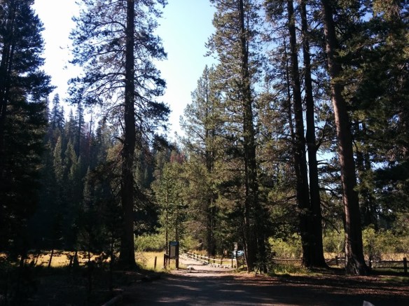
We took a shuttle from Mammoth Mountain Adventure Center to the Devils Post Pile trailhead. The trail splits off into several directions at the beginning, connecting to the Pacific Crest Trail and other parts of the the Mammoth Lakes area. The JMT itself is not marked (with the exception of some hand written directions), but follow the trail towards Shadow and Garnet Lake. I like to stress that it is important to know your next water source, considering the markings are the JMT are nearly non-existent in this section.

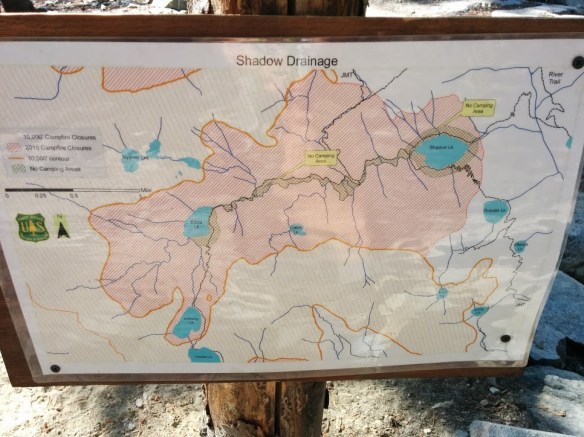
We passed Johnston Lake around 12:00 and settle down for lunch before continuing on, passing Vivian Lakes and Gladys Lakes. Sections between Rosalie, Ediza, and Shadow Lakes are protected and do not allow camping, something to take into consideration when planning. Several signs are posted throughout the trail warning hikers to camp elsewhere.

I arrived at Rosalie Lake awithin an hour and found a rock to sit and rest. It was a warm day at lower elevation but Rosalie Lake offered a cool area to sit and relax. I took a short nap waiting for the rest of my team to catch up.


The hike to Shadow Lake requires some climbing up switch backs is a 100 ft climb up followed by a near 700 ft descent into Shadow Lake. The trail became significantly more active. I ran into a lot of JMT north to sound bound hikers and stopped to talk to a few. Many mentioned how crowded certain camp sites were and offered suggestions for the best places to camp. Many warned that Garnet was a wind tunnel and they had a hard time getting a good nights rest the night before.

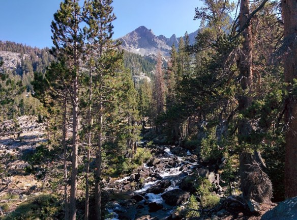
Shadow Lake was calm and quite, I stopped for a quick photo on the shoreline and continued on following Shadow Creek (no camping). The creek was a number of short water falls. With the warm weather, quite a few skinny dippers were taking a swim in the pools. Just shy of a mile from Shadow Lake, I hit the Ediza Lake junction. The JMT continues north towards Garnet Lake. The trail towards Ediza follows the Shadow Creek. There are two smaller lakes off trail (Clarice and Laura), but the junction is the last reliable water stop before getting to Garnet Lake.
The hike towards Garnet was a steady climb with a few switch backs. The snow melt left green grassy meadows with some small flows near the water. I got to Garnet Lake around 6 PM, the perfect time to crest over the top of the ridge line as the sun was slowly setting. The warnings from other hikers were true, Garnet sits below a canyon and it was a natural wind tunnel. Losing day light fast and not having seen the rest of my companions for a couple hours, I planned to find a good camp site. I hiked around but all the camp sites were full. I continued on to check the northern side of the lake, stopping briefly at the bridge crossing to get water. The bridge provided some protection from the wind as I filled up.


Having failed in finding a good campsite, I climbed over the ridge past Garnet, making time to look over to see if my companions would show up. With day light almost gone, I hastily hiked towards Ruby Lake, looking for designated campsites. I descended down several switchbacks into Ruby Lake around 6:30-6:45 PM and found a flat camp site off the trail. I had the lake to myself, a difference from what I saw at Garnet. I pitched my tent and waited for about an hour for my companions before I started making dinner and settled in for the night.


Ok to be totally honest hiking is not for us. But it is great to see what it looks like through your lenses!
Backpacking is not for everyone, thanks for checking out our post!
I plan to hike this section of the JMT this summer (2017), but southbound. I’m confused by your comments from the point where you’re at Rosalie Lake, then hiking north towards Shadow Lake. Your comments say, “The hike to Shadow Lake require some climbing up switch backs.” However, looking at my topo it appears that you should be descending approximately 640 ft down switchbacks from Rosalie to Shadow. Can you clarify this? Thank you!
I plan to hike this section of the JMT in summer 2017, but southbound. Your comments about hiking north from Rosalie Lake to Shadow lake are confusing me. You state, “The hike to Shadow Lake require some climbing up switch backs.” But looking at my topo, it appears that there’s approximately a 640 foot elevation gain if you’re hiking south from Shadow to Rosalie, so if you’re going north, as in your case, you should be descending. Can you clarify that for me? Thank you!
I am trying to do this off of memory (and Google Maps and CalTopo), I am showing a 100 ft climb up from Rosalie, and then a roughly 690 ft descent down to Shadow. I will fix my write up!