Trail Report- Lost Coast Trail Day 0 and 1

P1080159

The Quick and Dirty:
Location: 
Lost Coast Trail – Black Sands Beach to Gitchell Creek to Punta Gorda
Distance:
Day 0 – Drive 11 hours to Black Sands Beach/Shelter Cove, hike 3.9 miles to Gitchell Creek
Day 1 – Hike Gitchell Creek to Punta Gorda – approx. 18 miles
dtrip. 
Difficulty:  Moderate. Two, five mile stretches of low tide crossing area from Gitchell Creek to Miller Flats and Randall Creek to Sea Lion Gulch that hikers need to be aware of. 
Duration: 1.5 hours for from Black Sands Beach to Gitchell Creek. 9 hours from Gitchell Creek to Punta Gorda, with 4 hour break at Randall Creek.

Continue reading

Overview of the Lost Coast Trail, California

P1080196

UPDATED October 26, 2016

Over the next month, we will be reporting on our trip through the Lost Coast.  The posts will include our daily trip diaries, food preparation, and current conditions and tips.  We plan to revisit and update the posts as we think of new ideas and new resources.

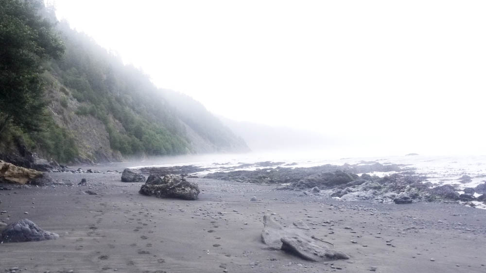
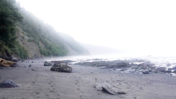
The Lost Coast trail is located in Northern California in Humboldt County. The shoreline at the southern end of the trail is so seismically unstable, the Pacific Coast Highway (Hwy 1) had to be moved miles inland.  Out of all the trekking trips on our to do list, the Lost Coast trail has long been on the top of the list. Being Californians, we felt this was a classic trail we had to tackle.

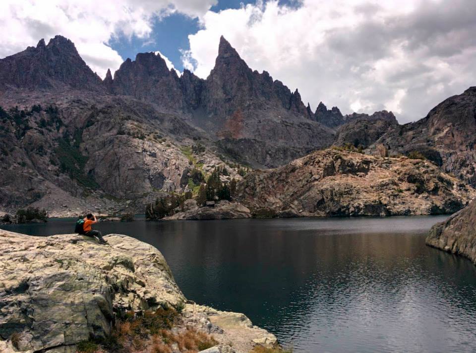
The 11 hour drive from Orange County has always been the main deterrent for us. However, due to the high number of fires in the Sierras, we had to cancel our week-long section hike of the John Muir Trail (JMT) and immediately jumped into planning the Lost Coast Trail after we heard a rumor about a potential quota restriction next year (see Permits and Restrictions for more details).

The Quick and Dirty:
Location: 
Located in Humboldt County, California.  The Lost Coast is broken into two sections, the Kings Range Wilderness and the Sinkyone Wilderness State Park. The Kings Range Wilderness section, which is the most popular stretch of the Lost Coast Trail, is located at Mattole Beach to Black Sands Beach in Shelter Cove.
Distance: 25 miles on the north trail, one way. We hiked from the southern end to north and back (50 miles total). While flat, the trail was tough because of the rocky terrain and soft sand.
Best Time: Year round, the area gets around 100 inches of rain every year. 
Duration: About 3.5 days with early mornings and afternoon breaks to wait for low tide. 
Permits and Restrictions: Permits can be obtained at either Matthole Beach or Black Sands Beach trailhead until January 8, 2017. Beginning January 9, 2017, advanced backcountry permits will be required.  Click here for more details. Make sure to obtain a fire permit online or at the ranger’s office if you plan on using a stove for cooking. A bear canister is also required for this trail and available for rental at the local BLM office.  As of September 2015, The ranger stated their may be a quota implemented in 2016.  Dogs are allowed on the trail. We did not bring Dakota with us because we were concerned the coastal terrain would be too hard on her paws.

Continue reading

Trail Report- Devils Postpile National Monument, Minaret Lake Trail

The Quick and Dirty:
Location: 
Devils Postpile National Monument is located close to Mammoth Lakes resort, the drive time to the trail head was approximately 6 hours from Orange County. Park your car at the Village in Mammoth Lakes and take the Reds Meadow/Devils Postpile shuttle bus service ($7/person RT) to the Devils Postpile trail head. 
Distance: ~6.5 miles to the entrance of the Minaret lakes, there’s about 2 additional miles of unmaintained trail to explore once you’ve reached the lakes. 13 miles roundtrip. 
Difficulty:  Easy, total elevation gain of about 2500ft over 6.5 miles 
Best Time: summer and fall 
Duration: 3.5 hours at a leisure stroll to the lake
Permits: Wilderness permits are required for all overnight stays. Permits can be obtained at recreation.gov. Keep in mind, this is a popular trail, daily quotas fill quickly. 
Dogs: Dogs are allowed on the shuttle and trail, however, they do require dogs to wear a muzzle on the shuttle.

minarets2

Minaret Lakes

Continue reading

Trail Report- San Jacinto Peak via Marion Mountain Trail

The Quick and Dirty:
Location: 
San Jacinto Peak is located within San Jacinto State Park on Highway 243, the nearest city to the state park is Idyllwild. 
Distance: 10.4 miles round trip to San Jacinto Peak via Marion Mountain Trail
Terrain Type: This 5.2 miles one way trip to San Jacinto Peak is a steady 4,600 ft elevation climb.
Difficulty:  Strenuous
Best Time: Year round
Duration: 6 hours and 30 minutes. It took us 3.5 hours going up and 3 hours coming down.
Permits: Wilderness permits are required for both day and overnight hikes. The day use permit can be obtained at the ranger’s station in Idyllwild or at the Long Valley Ranger Station, there is no quota limit on day hikers. Overnight permits will be accepted up to 8 weeks in advance. See link below for the Wilderness Overnight Permit. Ranger station hours are daily from 8AM-4PM. 
http://www.parks.ca.gov/pages/636/files/dpr409.pdf
Dogs: Dogs are not allowed in the State Park however, there are many campsites around the area that belongs to the National Forest and allow dogs. We plan to explore this area more with Dakota on our next trip.

IMG_20150524_145303

Beautiful view of San Jacinto Peak

Continue reading

Trail Report- Foresee Creek, San Bernardino National Forest

The Quick and Dirty:
Location: Located within San Bernardino National Forest in San Bernardino County, California. The trail head is located on Jenks Lakes Road West off Hwy 38. Follow sign for Foresee Creek Trail to a dirt road, the parking lot is approximately a quarter mile away from Hwy 38.
Distance: 13 miles round trip to San Bernardino peak trail junction via John’s Meadow.
Terrain Type: Relatively flat from Foresee Creek trailhead to John’s Meadow. There is a 200+ feet climb from John’s Meadow to the main San Bernardino peak trail junction closest to Columbine Springs. This trail is unmaintained but navigable. Water is available year round on this trail.
Difficulty:  Easy to moderate, we were able to keep a little over 3 mile per hour pace for this hike.
Best Time: Year round but spring or after a rain storm is the best time.
Duration: 5 hours include 30 minutes of lunch break
Permits: Wilderness permits are required for all day and overnight hikes. The permit can be obtained up to three months in advance at the Miller Creek Ranger Station. For more information, see the following link for instructions on how to obtain a permit. You do not need a National Forest Adventure Pass to park at the trailhead. http://www.sgwa.org/permit.htm
Dogs: Dogs are allowed on this trail

IMG_20150523_123055

Continue reading