Trail Running the James Dilley Greenbelt Preserve

The Quick and Dirty:

Location: James Dilley Greenbelt Preserve is located north of Hwy 73 on Laguna Canyon Road inside Laguna Coast Wilderness park in Orange County, California. Use this Google Map link for exact driving directions and use this link for the trail map.
Distance: About 3.4 miles on the Lake, Edison and Ridge Top trail loop (this is the outer loop of the preserve) and additional 2 miles for the Canyon Trail to the Mariposa Trail loop (this is the inner loop of the preserve).
Difficulty:  Easy hike, moderate trail run, lots of good rolling hills for a good workout.
Duration: It took us about 1 hour to finish the 5 mile run with a break at the top of the ridge line.
Dogs Allowed? No dogs or mountain biking are allowed inside the preserve.
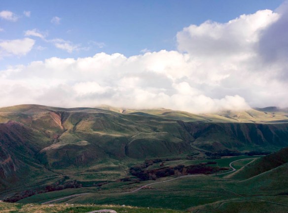
Best time to visit: Year-round but spring during the wild flower season is a great time to see all the California native wildflowers blooming inside the preserve.
Trail Parking: Parking is $3 at the designated preserve parking lot. There was plenty of parking early in the morning when we started the run but the lot got pretty full by the time we left.

James Dilley Sign.JPG

The entrance to the James Dilley Greenbelt Preserve on Laguna Canyon Road shortly passing Hwy 73 heading northbound.

Continue reading

Trail Report- Momyer Creek Trail

The Quick and Dirty:
Location: 
Momyer Creek Trail to Dobbs Cabin campground, see rough trail map from Caltopo.
Distance: About 3.8 miles to Alger Creek campground and 5.9 miles to Dobbs Cabin (Dobbs) campground
Difficulty:  Moderate, it’s a short hike for a backpacking trip but there’s about 1,500 ft of elevation gain to Dobbs campground.
Duration: Overnight backpacking trip
Dogs Allowed? Yes, Dakota joined us on this trip as dogs are allowed in San Bernardino National Forest
Best time to visit: Whenever there is water! Water in the creeks seem to be plentiful on this trail, we’ve been during spring and fall and have always had luck. You may want to avoid hiking during the hottest months of the summer as the switchback section are exposed to full sun.
Trail Parking: Located close to the town of Forest Falls, there is a designated parking lot next to the trail head and parking has been manageable the last two times we went hiked this trail. On weekends, if you arrive later in the day, the lot does eventually fill up with day hikers. National Forest pass is required to park at the trail head.

trail sign.jpg

Nice trail sign at the trail head

Continue reading

MTB Trail Report- Arroyo Trabuco – Tijeras Creek Loop

The Quick and Dirty:
Location – Starting off at the south end of O’Neill Regional Park on Mesa trail, the Arroyo Trabuco – Tijeras Creek loop takes you around the city of Ranch Santa Margarita. See route on geoladders.com.
Distance – It is roughly a 14-mile loop if you don’t miss the turnout to Tijeras Creek like we did.
Terrain Type – Mix of double track and single track.  Rocky stretches, creek crossings, wood stretches and sand.
Difficulty – Good for beginner-intermediate mountain biking with a few climbs where I had to descend my bike and walk up the hill
Best Time – Year-round, there are a few stream crossings that can get quite deep after a big rain storm. Personally, I do think spring is the best time to see this trail, because everything was still lush from the recent rain events.
Parking- Parking at O’Neill park’s main lot is not free, we park on El Camino Montana Road parallel to the Mesa Trail.

IMG_20160221_163605_1.jpg

Chasing the sunlight at the end of the ride

Continue reading

MYOG: Back Country “Sound System”

Quick and Dirty
Cost: none
Difficulty (1-10): 1

What You Need
Cooking pot
Phone with a speaker with your favorite podcast downloaded

I love listening to podcasts and audio books. It was something I picked up during graduate school when I walked 2-3 miles to campus everyday.  This was a great way for me to catch up on current events and books when I wouldn’t have had the time otherwise.

As I graduated school, I continued to listen to my podcasts during our backpacking trips. It’s a way we spend some of our downtime after a long day of hiking. While we were backpacking the Lost Coast trail, we found it hard to hear the audio on my phone since we were camping right on the beach. Louis came up with this brilliant idea of using our 4qt cooking pot as an amplifier. It worked brilliantly on and brought us great entertainment on the trip!

To have your own speaker’s amplifier the next time you are outdoors, all you need is a cooking pot or an enclosed container and your cell phone with a working speaker. Insert the phone into the pot with the speakers facing up and enjoy your favorite podcast without having to carry the extra weight of an external speaker!

sound system.jpg

Back country sound system. Suntactics sCharger -5 and Iphone 5C with a 4 qt pot amplifier.


.

Weekend Getaway- Wind Wolves Preserve

We visited the Wind Wolves Preserve in Bakersfield, California this past weekend with Louis’s sisters and their significant others. This is one of the 12 preserves run under the Wildlands Conservancy in California. It was our first time at the Wind Wolves Preserve but we’ve visited the Oak Glen Preserve in Yucaipa, California last year.

Good to know:

  • Location: The preserve is located at 16019 Maricopa Highway, Bakersfield, CA 93311 and it takes a little under 2 hours to get there from Los Angeles.
  • Camping at San Emigdio Campground is free and available at the park with reservation, we emailed Courtney Carter to make our reservations a couple weeks in advance. Check in for campsites is daily between 2PM-4:30PM and checkout is at 10AM. No late arrivals is allowed after 5PM.
  • Fees: There are no fees to use and visit the reserve or camp, however, since this is a nonprofit organization, they do suggest $5 donation per individual or $10 per family.
  • Dogs: Dogs are allowed on the preserve but are not allowed to participate in the organized hikes
  • Campfires: Unfortunately, no campfires are allowed due to the dry climate in Bakersfield.
  • Additional information can be found on the Wind Wolves Preserve webpage and their facebook page for photos.

    IMG_20160123_152715

    Tule Elk Viewing Area, Wind Wolves Preserve

Continue reading