

The Quick and Dirty:
Location: Lost Coast Trail
Distance: Hike from Spanish Flats to Gitchell Creek – 12 miles
Difficulty: Moderate
Duration: 8 hours
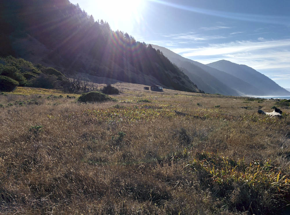
After a windy night, we got up late the next morning, packed up our gear and headed to Spanish Creek to wash up and purify water for breakfast. Spanish Creek has a lot of natural wind breaks. My assumption is during this time of the year, it is probably one of the better campsites in the area.

We took our time, knowing the trail in front of us was hard packed and on the bluff tops and we were not expecting to hit low tide till about 7PM that night to cross through to Gitchell Creek.
By the time we were at Miller Flat waiting for the low tide, we had caught up to everyone starting from Mattole Beach the day before. It was great catching up with people and hearing about their trip. We heard from one group was stuck in the middle of the high tide area. Luckily, they climbed onto a high enough rock and waited there for 6 hours for the tide to go down before finally passing! Careful descending down onto the coast, the rock wall is near vertical.
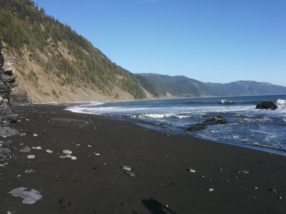
We started crossing around 4:30PM, just low enough to dodge the water, but high enough for us to walk on the stones and rocks instead of the soft beach sand. We passed Shipman Creek and Buck Creek, where all the other groups were stopping at and soldiered onto Gitchell Creek and reached camp just before sunset.

We had a beautiful sunset on our last night at Gitchell Creek. Gitchell is probably one of the better campsites. Winds were calm and there is plenty of space on the beach between the shoreline and the creek. Aside from the wet and clammy weather, our last night was a good cap stone to trip.
Part 4 – Gitchell Creek to Black Sands Beach and Sinkyone Wilderness State Park

Pingback: Overview of the Lost Coast Trail, California | Hike Now, Work Later