

Modjeska Peak and Santiago Peak
The Live Oak – Vista – Hoffman Homestead – Coyote Loop (loop) follows three trails in the O’Neill Regional park. The short hike has great views of Orange County, Trabuco Canyon, and the Saddleback Mountains.
The Quick and Dirty:
Location: O’neill Regional Park
Distance: Approximately 3.5 miles
Difficulty: Moderate
Duration: 1.5 hours
Dogs Allowed? No, dogs are only allowed on the paved trails and campgrounds in O’Neil Park
The Live Oak Trail traverses through three parks in the Orange County Parks system (O’Neill, Whitings Ranch, Limestone Canyon). The trail climbs out of O’Neill Regional Park/Trabuco Canyon and follows the ridge line over the City of Rancho Santa Margarita. Vista Point is the highest point on the hike, which offers views of the Saddlebacks and the city of Dove Canyon. The park map offers the best map available. Google maps does not properly show all the marked trails in O’Neill Regional park.
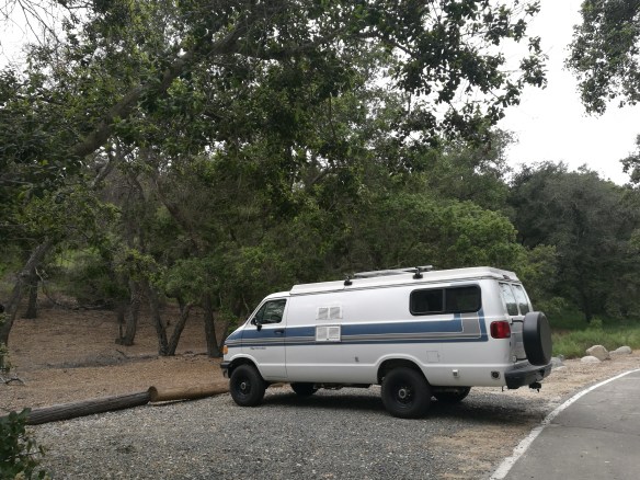
Sportsmobile parked at the trail head
Once you pull through the ranger station, take the first right turn and make an immediate right just before the day use parking lot. Follow the road until you hit the first parking lot on your left.


The trail starts just past the gates, but we prefer to take the short trail that cuts through the oak trees grove. Once you hit the pavement, follow the Pawfoot Trail for about a mile up towards the Live Oak Trail junction. The Pawfoot Trail may have wild flowers growing if you are hiking in the spring. The paved road runs parallel.


The Live Oak Trail immediately starts with a climb and a few switch backs up to a plateau area. Make sure you take the sights in. As the trail climbs, you get views of both the City and the mountains. At the top of the Live Oak Trail, continue on until you pass the Coyote Canyon junction. The trail descends quickly, and ascends steeply towards a radio tower. Once you pass the radio tower, you will see a seasonal pond to your left. To the right is the climb up to Vista Point and the Vista Trail.


Vista Point offers great views of Orange County. On a good day you can see Catalina Island and the Channel Islands to the west, and the Saddleback Mountains to the east. The polished welded pipes tell you the object they are pointed at.


To head back to the trailhead, head down Vista Trail. Vista Trail switches back and forth down to the base of canyon. Just under three quarters of a mile, you will hit the junction to Hoffman Homestead Trail. This mile and a half trail parallels Live Oak Canyon Road and the park road. Follow the trail until it hits a paved road. A trail sign will point you in the direction of the trail. Eventually you will cut across the road and hit the Hoffman Homestead – Coyote – Rascal Trail. Follow the Coyote Trail for about a quarter of a mile back to the parking lot.
For a shorter hike, you may turn around at Vista Point and following the Live Oak Canyon Trail, or heading down the Coyote Canyon trail.
For more information on camping and hiking at O’Neill Regional Park, visit this page.

Nice photologue of the trail features. It’s always need to see the uniqueness of trails from different regions. The large etched map is particularly neat. Thanks for sharing. Keep exploring…Happy Trails! MG
Appreciate the comment, thank you!